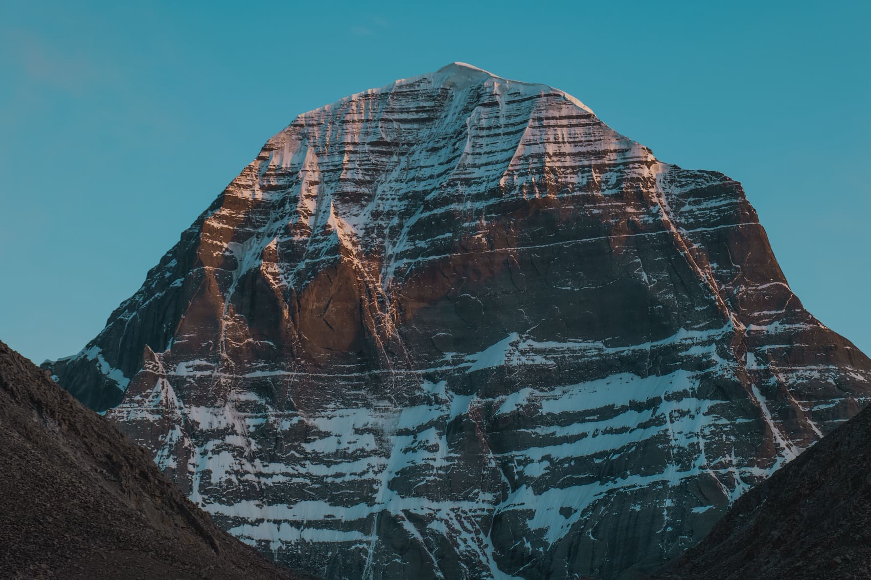
Route Map for the Kora Around Mount Kailash

The Kora around Kailash is not a walk through signposts. The route runs at an altitude of 4600–5630 meters, takes three days (sometimes two if the pace is fast), and every turn is connected to a story, monastery, or power spot. To help you visualize the path in advance and understand where everything is located, I’ve compiled a practical map with key points, distances, and elevations. Everything I describe here has been experienced with groups for multiple seasons.
Overall Route Overview
The Kora is a closed loop measuring 52–56 km (depending on which side trails you include). The start and finish are in the village of Darchen (4560 m). The route goes counterclockwise, as is customary for Buddhists and Hindus; Bonpo followers go clockwise. The highest point is the Drolma La pass (5630 m), which is crossed on the morning of the second day.
- Three Classic Stages:
- Day 1: Darchen → La-chu Valley → Dirapuk Monastery (20 km, elevation gain of 600 m).
- Day 2: Dirapuk → Drolma La Pass → Lham-chu-khir Valley → Zutulpuk Monastery (18 km, ascent of 700 m, descent of 1200 m).
- Day 3: Zutulpuk → Darchen (14 km, gentle descent).
If health and acclimatization allow, some pilgrims complete the Kora in two days: the first day to Dirapuk, the second day over Drolma La and straight back to Darchen. In our groups, we recommend a three-day schedule: it is safer and allows time for practice and contemplation.
Key Points on the Map
Darchen (4560 m)
The base village. All guesthouses, tea houses, and shops with thermoses and cookies are located here. From here, you can see the southern slope of Kailash. You will arrange your permit at the pilgrimage center office, hire a yak or porter (if needed), and buy water. On the morning of the first day, you head north along a wide dirt road, which also serves as a jeep track for transporting gear to the monasteries.
Coordinates (approximate): 30.3832° N, 81.1676° E.
Tarboche (4730 m) 8 km from Darchen
A huge ritual flagpole around which a ceremony takes place every year during the full moon of the Saga Dawa month (April-May): the old pole is replaced or the prayer flags are renewed. This spot is considered the official start of the inner Kora. Here, people stop to take photos, adjust their backpacks, and drink tea from thermoses. The trail then leads into the La-chu river valley; the western wall of Kailash opens up on the left.
Choku Gompa (4900 m) 13 km
A small monastery on the western slope. It operates in summer and is closed in winter. You can enter, receive a blessing, and leave an offering. Nearby is a stream where pilgrims collect water. People usually stop here for a snack: thermos, bars, dried fruits. The altitude is already felt, and the pace drops.
Dirapuk Monastery (5080 m) 20 km
The end of the first day. The monastery stands right under the northern wall of Kailash, and the view at dawn is fantastic. There is a guesthouse (spartan rooms, bunks, and a shared toilet outside), a dining room with a thermos and noodles. Electricity is provided by a generator, available in the evening for a couple of hours. There is no mobile reception. You will spend the night at 5080 m, and the body needs to adapt, so we always advise going to bed early, drinking warm liquids, and not overeating.
Coordinates: ~30.4766° N, 81.1457° E.
Drolma La Pass (5630 m) 27 km from Darchen
The highest and most sacred point of the Kora. The ascent from Dirapuk takes 4-5 hours, is steep, and has boulders. The trail winds up, and in the last few meters there are stones, snow, and wind. At the top of the pass is Drolma-Dod rock, adorned with prayer flags; pilgrims leave something personal (a lock of hair, a piece of clothing) as a sign of symbolic death of the past. The views are 360° if the weather is clear. The air is 40% less than at sea level; it’s important to move slowly and breathe evenly.
Coordinates: ~30.5141° N, 81.1278° E.
The descent from the pass is steep, dropping 400 m in an hour, down to Gauri Kund Lake.
Gauri Kund (5210 m)
An emerald lens of water in a stone bowl. In summer, the shores melt, and in winter, the lake is covered in snow. Hindu pilgrims wash themselves (some dare to plunge in), the water is icy. Buddhists walk around the lake clockwise. Here is the first gentle section after the pass, allowing you to catch your breath.
Zutulpuk Monastery (4790 m) 38 km
The end of the second day. The name translates to “Cave of Wonders,” and inside the monastery is a small grotto where, according to legend, Milarepa meditated. Conditions are similar to Dirapuk: a guesthouse, dining room, bunks, and a generator. Pilgrims recover here after Drolma; the atmosphere is calm, and groups relax.
Coordinates: ~30.4358° N, 81.2172° E.
Finish at Darchen (4560 m) 52 km
The third day features a gentle descent along the Dzong-chu river. The trail is wide, the mood is light, and the body has already adapted. After 4-5 hours, you are back in Darchen. Traditionally, at this moment, it is customary to thank companions, the guide, and yaks; the Kora is complete.
Forks and Side Trails
- Inner Kora: after Zutulpuk, you can turn onto the trail to the southern wall of Kailash; this route is for experienced trekkers, reaching up to 5800 m, and requires an additional day. Access is restricted: you must complete the outer Kora 13 times.
- To Gyangdrak Monastery: a side branch from Tarboche heading east to an old monastery with a view of the southern wall. It adds 2-3 km, but offers a beautiful perspective.
- Shortened option by jeep: from Darchen to Dirapuk can be reached by jeep (an hour on a dirt road), but most pilgrims consider this a violation of the essence of the Kora, as it is meant to be done on foot.
Practical Navigation
- GPS Tracks: I recommend downloading them in advance (in .gpx format) for apps like Maps.me or Gaia GPS. There is no internet on the route, and a paper map is a backup option.
- Signage: At key forks, there are stone piles (cairns) and faded signs in Tibetan/English. In fog or snow, it is easy to get lost, so go with a guide or in a group.
- Distance Markers: Along the trail, you may occasionally find posts marking distances from Darchen. Their accuracy varies as not all are updated.
Altitude Profile (Simplified)
| Point | Height, m | Distance from Darchen, km |
|---|---|---|
| Darchen | 4560 | 0 |
| Tarboche | 4730 | 8 |
| Choku | 4900 | 13 |
| Dirapuk | 5080 | 20 |
| Drolma La | 5630 | 27 |
| Gauri Kund | 5210 | 29 |
| Zutulpuk | 4790 | 38 |
| Darchen | (Finish) | |
| 4560 | 52 |
Maps and Applications
- Paper map of the Kailash Region (Nepa Maps or Gecko Maps series): available in shops in Kathmandu and Lhasa, scale 1:125,000. Reliable, but with average detail.
- Maps.me: works offline, shows trails, monasteries, and streams. Accuracy ±50 m is sufficient for general orientation. Gaia GPS / OsmAnd: more advanced tracks, can load terrain layers. Batteries drain quickly in the cold, so bring a power bank. Coordinates in Google Maps: you can mark key points in advance, but there will be no internet on site, so save the map offline.
Orientation Tips
- Follow the flow of pilgrims: in summer (May-September), the Kora is popular, and there is always someone on the trail. In winter and off-season, you may find yourself alone, so GPS is essential.
- Landmarks: Kailash is visible for almost the entire route (except for sections in the gorge); its peak serves as a natural compass.
- Weather: fog on Drolma La is common. If visibility is zero, wait in shelter or descend slowly, staying on the trail.
- Do not walk at night: Dirapuk and Zutulpuk monasteries are the only overnight accommodations. Attempting to walk in the dark is dangerous due to rockfalls, frostbite, and disorientation.
What to Bring for Navigation
A smartphone with offline maps (in a waterproof case). A 20,000 mAh power bank (batteries drain twice as fast in the cold). A paper map in a waterproof case. A compass (old school, but works without batteries). A headlamp with spare batteries if you leave before dawn for Drolma.
Communication and Safety
- Mobile reception: in Darchen, China Mobile works (you need a Chinese SIM), but there is none on the route.
- Satellite phone: if you are going in winter or with a small group, it makes sense to rent one (in Lhasa, ~$10-15/day).
- Checkpoints: we at record the time of departure from Dirapuk and arrival at Zutulpuk; if someone is delayed, the guide returns to search.
Interactive Resources (Offline Preparation)
Before your trip, it’s useful to "virtually" walk the Kora:
- Google Earth: download the .kmz file of the route (can be found on trekking forums), spin the 3D terrain to see the scale of the ascents.
- YouTube videos: channels of pilgrims and tourists provide insight into the pace, trail conditions, and weather by seasons.
- Altitude graph: sketch yourself a profile of the days on paper; it’s psychologically easier when you know where the peak loads will be.
Personal Experience: I remember the first time I led a group, and one participant asked at Drolma, "Is it all downhill from here?" I pointed to the map showing the descent to the lake, then the gentle section to Zutulpuk, and saw relief in their eyes. The map provides not only the route but also an inner support: you know where you are, how much is left, and what lies ahead. It alleviates some anxiety and allows you to focus on your practice rather than fear of getting lost.
If you plan to do the Kora independently, take the time to study the map, print it out, mark sleeping points, and estimate transition times considering your pace. If you are going with an organized group (like us at ), the guide will handle navigation, but understanding the route will still add confidence. The Kora is not just a physical journey but an inner one; the map helps make the external route simple so that the focus remains on the main thing.
Route Map for the Kora Around Mount Kailash
Introduction to the Kora Around Kailash
The Kora around the sacred Mount Kailash is both a physical journey and a spiritual trial. The route, approximately 52 kilometers long, attracts pilgrims from various traditions: Buddhists, Hindus, Bon practitioners, and Jains. Every step here is steeped in history, myths, and living faith; this is immediately felt when you see people prostrating on the rocky trail or hear the rustle of prayer flags at the pass.
A Brief Description of the Route and Its Sacred Significance for Buddhists and Hindus
For Hindus, Kailash is the abode of Shiva; for Buddhists, it is the place of power of Buddha Chakrasamvara. Completing the Kora means purifying oneself, coming closer to enlightenment, and in some traditions, closing the cycle of karma and freeing oneself from suffering. The mountain itself remains inaccessible for climbing; no expedition has ever reached the summit—this is a taboo respected by all.
On the route, you will encounter ancient monasteries such as Chuku, Dirapuk, and Dzultripuk, as well as the high Dolma La pass (5,630 m), from which you can see the northern face of Kailash. You will witness the sacred lakes Gauri Kund and Manasarovar and meet Tibetan pilgrims performing the full prostration Kora (this can take weeks).
Practical aspects of the route:
- Duration: 3 days at a moderate pace, sometimes 2 days for well-prepared groups; the full prostration Kora takes 2–3 weeks.
- Altitude: starting at about 4,600 m, with Dolma La at 5,630 m; acclimatization is critical.
- Difficulty: rocky trails, sharp elevation changes, and variable weather ranging from sunshine to snowfall within an hour; physical preparation is desirable, but people of all ages complete the Kora.
Planning Your Trip with
Honestly, the Kailash route is one where the small details matter: proper acclimatization, an experienced guide, and logistics with permits. We at have been doing this since 2027, accompanying groups from Lhasa to Kailash, organizing overnight stays in guesthouses, and taking care of documents and transportation so that you can focus on your inner journey rather than on everyday concerns.
What to consider when preparing:
- Budget: The cost of tours with Kora from Lhasa ranges from 1,200 to 1,800 USD per person (depending on group size, accommodation level, and season). The price usually includes permits, transportation, basic accommodation, and guidance; meals on the Kora are partly covered. Set aside an additional 150–250 USD for personal expenses: souvenirs, tips for porters, donations in monasteries, hot tea in guesthouses.
- Visa and Permits: A Chinese visa and a Tibet Travel Permit (TTP) are required for Tibet, which is obtained through a travel agency; independent entry is not possible. An Alien's Travel Permit for the Ngari area (where Kailash is located) and a Military Permit are also needed. We handle the paperwork—you only need a passport (valid for at least 6 more months) and a copy of your Chinese visa.
- Hidden Expenses: Meals along the route: breakfasts and dinners in guesthouses cost 5–10 USD, lunches can be snacks from your supplies or tea in teahouses (3–5 USD). Medical insurance covering high-altitude routes (up to 6,000 m) is mandatory; standard policies do not cover Kailash. Porters or yaks for backpacks: 20–30 USD per day; if you feel it’s difficult to carry weight at altitude, it’s better to hire in advance. Oxygen canisters at the pass (available for purchase on-site) are around 5 USD; many do not need them, but it's good to have a backup.
- Money-Saving Tips: Join group departures to share costs for transportation and guides; individual tours are 40–60% more expensive. Bring nuts, dried fruits, and energy bars from home—these are more expensive in Tibet, and the selection is limited. A thermos and water filter will save you money on purchased water (1–2 USD per bottle at altitude).
The Kora around Kailash leaves a mark not only in memory; it changes something inside. We have seen this in our groups time and again. If you are ready for this experience, we invite you to complete the route with us: Kailash through Nepal with Gosainkunda or the classic tour from Lhasa.
Map of the Kora Route Around Mount Kailash
Detailed Map of the Kora Route

The Kora around Kailash is a 53-kilometer path, and each section has its own character, altitude, and significance. In practice, the route is divided into three stages: from Darchen to Dirapuk, ascending through Dolma La pass, and descending to Zutulpu. Below is a description of the key points you will pass, with altitudes and nuances to know in advance.
Description of Key Points Along the Route
Darchen (4,600 m) is the starting and finishing point of the Kora. It is a small village with guesthouses, shops, and teahouses, where you can buy trekking poles, thermoses, and energy bars. You will spend the night here before starting the trek, arrange your permit for the route, and if needed, hire a porter or yak for your backpack. The views of Kailash from here are already impressive; the southern face is fully visible.
Dirapuk (4,900 m) is the first overnight stop on the Kora, about 20 km from Darchen. The camp is located at the foot of the northern face of Kailash, and in the morning, if the weather is clear, you will see the first rays of the sun touching the summit. There is a simple guesthouse with shared rooms, sometimes with oxygen canisters for those feeling the altitude. I recommend taking an evening walk to Dirapuk Monastery; the views are worth it, even if you are tired.
Dolma La (5,630 m) is the highest point of the Kora, a pass that is considered the spiritual center of the entire route. The ascent is steep, gaining about 400 m of elevation over 4–5 km, and here the lack of air is often felt. At the summit, there is a sea of prayer flags, stones left by pilgrims, and Gauri Kund lake. Many leave a symbolic item—a button, a coin, a lock of hair—as a sign of release from the old. The descent begins immediately and goes steeply down.
Zutulpu (4,750 m) is the second overnight stop, about 12 km from the pass. The name translates as "cave of wonders"; according to legend, Milarepa meditated here. The guesthouse is simple, but after the pass, any roof over your head feels like a gift. In the morning, it remains about 10 km back to Darchen, a gentle descent through the valley, already without dramatic climbs.
Altitudes and Route Profile
Understanding the altitudes is important for planning your pace and distributing your strength. Here are the main points:
- Darchen: 4,600 m
- Dirapuk: 4,900 m
- Dolma La (pass): 5,630 m
- Zutulpu: 4,750 m
- Return to Darchen: 4,600 m
The elevation gain from Darchen to the pass is about 1,000 meters, and this is the main challenge. The descent is faster, but the knees also get tired. If you want to see a detailed elevation profile and learn how we organize acclimatization, check out the program Kailash: Sacred Kora from Lhasa or the route Kailash through Nepal: Kora with Gosainkunda.
Useful Tips for Travelers
Budget and Expenses
The cost of an organized tour on the Kora with full support, transportation, a guide, and accommodation ranges from 800 to 1,500 USD depending on the route (through Lhasa or Nepal) and comfort level. This amount usually includes: Transportation (jeep, bus)
Guide and Tibetan permit Accommodation in guesthouses on the Kora Main meals
Excluded and additional costs to consider: Meals in Darchen and along the way before/after the Kora are about 10–15 dollars per day Hiring a porter or yak for the backpack costs 50–100 dollars for the entire route Souvenirs, donations in monasteries, thermos, trekking poles Medical insurance covering altitudes up to 6,000 m is mandatory
Visa and Documents
To enter Tibet, a Chinese visa and a special permit (Tibet Travel Permit) are required, which is issued by a travel agency. You cannot enter Tibet independently—only as part of an organized group with a guide. Make sure your passport is valid for at least six months after your return.
How to Save Money Join group tours; this shares transportation and guide expenses among participants. Bring nuts, bars, and dried fruits with you—the food selection in guesthouses on the Kora is limited, and prices are higher. Don’t buy bottled water every day—bring a thermos and fill it with hot water in guesthouses. If you plan to take photos or videos, check in advance if permits are needed; sometimes they are paid.
Honestly, the Kora is not a place where saving should come at the expense of safety or health. If you feel that you need a porter or an additional day for acclimatization, it’s better not to refuse. We always advise listening to your body and planning with a buffer; the mountains aren’t going anywhere, and neither should you.
Day 1: Darchen to Dirapuk

The first day of the Kora begins in the village of Darchen; here you will sleep in a guesthouse for the last time before starting the route. In the morning, the group heads to the gates of the sacred path, where pilgrims hang prayer flags and perform prostrations. The trail then gently follows along the Lha Chu river valley and gradually unveils the western facade of Kailash.
- Distance: about 18 km.
- Altitude: starting at 4,600 m, overnight in Dirapuk at 4,900 m.
- What you will see: the western wall of Kailash, valleys with stupas and prayer wheels, the first guesthouses for pilgrims. If the weather is clear, by evening the mountain is fully revealed, glowing pink at sunset.
What to Bring and How to Prepare
In our groups, each participant carries only a light daypack; the main gear is carried by yaks or porters. However, there is a basic kit that you should always have with you:- Clothing: Trekking boots with good ankle support (preferably already broken in). Thermal underwear, fleece, and a windproof jacket in three to four layers to regulate warmth. A hat, buff, and gloves (even in summer, mornings can be cold at high altitudes).
- In your backpack: 2–3 liters of water (can be replenished at streams, but it's better to have purification tablets). Nuts, energy bars, and dried fruits are light foods that provide quick energy. Sunglasses with UV protection and SPF 50+ sunscreen (the sun at this altitude is harsh).
- Health: Medications for altitude sickness (Diamox if recommended by a doctor), pain relievers, blister band-aids. Insurance that covers heights up to 6,000 meters and helicopter evacuation is mandatory.
- Miscellaneous: Power bank and cables (electricity in guesthouses is not always stable). Cash in yuan for tips, snacks, and donations at monasteries.
Honestly, the first day is not the most physically challenging, but many feel anxious psychologically. Go at your own pace, and don't hesitate to rest. If you feel a headache or nausea, speak to your guide immediately. It's better to be cautious at altitude.
Join our program Kailash: Sacred Kora from Lhasa — we have been leading groups since 2027 and know the route down to the details. You will travel light while we handle logistics, acclimatization, and safety.
Day 2: Dirapuk to Zutulpuk

On the second day of the kora, the trek from Dirapuk to Zutulpuk covers approximately 18 kilometers at an altitude of around 4,800 meters. While not the longest stretch, the altitude and weather can make it challenging. Be prepared for changes: it may be sunny in the morning, but by afternoon, you could encounter wind and snow.
Route Description
- Distance: about 18 km
- Altitude: 4,800 m
- Difficulties: Sudden weather changes from bright sun to snowstorm within half an hour. The altitude requires good acclimatization; if you feel a headache or shortness of breath, slow down. There are rocky sections, and parts of the trail can be slippery after rain or snow.
Acclimatization and Nutrition
Acclimatization here is not an abstract concept but a concrete task. Your body needs time to adjust to the altitude; there’s no need to rush.
- Acclimatization: Take more frequent breaks, even if it seems like you are moving slowly; this is normal at 4,800 m. Drink water constantly in small sips. Dehydration exacerbates the symptoms of altitude sickness. Completely avoid alcohol and smoking as they reduce blood oxygen levels.
- Nutrition: Carry nuts, dried fruits, and energy bars; they are light but calorie-dense. It's mandatory to have enough food for the entire day: there are no kiosks on the trail, only stores in camps. Hot tea from a thermos is a great support, especially if it gets cold.
Additional Tips
- Safety: Inform your guide of any discomfort: headaches, nausea, or dizziness. Altitude sickness can develop quickly. Stay on the trail and avoid cliffs, as rocks may be unstable.
- Equipment: Always have warm clothing with you: fleece, windproof jacket, hat. Weather can change instantly. A first-aid kit should be handy, including band-aids, pain relievers, and altitude sickness tablets (Diamox, as prescribed by a doctor). Check your medical insurance before the trip.
- Finances: Water and food in camps are more expensive than in towns. Have cash in yuan (cards are rarely accepted). A small amount for unforeseen expenses is a reasonable precaution.
If you want to see how we organize this section, take a look at the program Kailash via Nepal: Kora with Gosainkunda where we detail logistics, acclimatization, and support along the way.
The kora around Kailash is both a physical challenge and a spiritual practice. Honestly, it can be tough. But when everything is well thought out in advance—gear, pace, nutrition—the journey becomes a profound experience rather than a struggle for survival.
Day 3: Zutulpuk to Darchen

The final stretch of the kora is about 10 kilometers, with the altitude gradually decreasing to 4,700 meters. Physically easier than the Drolma-La pass, but many feel a wave of emotions here: joy, relief, a slight sadness that the circle has closed and the sacred mountain is left behind.
What Participants Feel at the Finish
In our groups, people return to Darchen in different states; some are silent and keep everything inside, while others cannot hold back tears. This is normal. Here are a few thoughts that are often shared:
- Connection with the Space: The silence of the valley, the wind in the prayer flags—a feeling that nature has taken you through your own boundaries.
- Understanding Oneself: Many notice that somewhere on the path, they let go of old fears, resentments, and fatigue from their usual lives.
- Gratitude: For the body that carried them; for the group that walked alongside; for the guides who ensured safety.
Honestly, I have never seen anyone finish the kora indifferent.
How to Recover After the Trek
Your body needs support at altitude; you have expended a lot of resources, even if you didn't feel tired.
- Water: Drink often in small sips. Dehydration is subtle at altitude, and the consequences—headaches and weakness—come later.
- Light Food: Soups, cereals, vegetables, and fruits (if available). Do not overload your stomach with meat and fatty foods; digestion at altitude is slower.
- Sleep: If possible, lie down during the day for an hour or so. Your body will recover faster.
- Budget for Rest in Darchen: Meals in guesthouses or cafes cost $10–15 per day per person; a hot shower (if available) costs $3–5; for souvenirs, incense, and offerings in the temple, budget an extra $20–30.
For more details on how we organize logistics, nutrition, and support after the kora, you can read about it in the program Kailash: Sacred Kora from Lhasa.
Returning to Darchen is a point where the physical journey ends, but the inner journey continues. Give yourself time to process this peacefully.
Best Time for Trekking Around Kailash

The route around the sacred mountain is not only a physical challenge but also an opportunity to enter a unique atmosphere where spirituality, altitude, and silence of the Tibetan plateau intertwine. The choice of season directly impacts what you will encounter: weather, the number of people, and the accessibility of passes. Below are insights from our groups and honest details for each period.
Climate Conditions and Optimal Seasons Spring (April-May)
Daytime temperatures range from 5–15 °C, while at night it can drop to -5 °C. Snow on the Drolma-La pass (5,630 m) is still thick, but trails begin to clear. There are noticeably fewer people than in summer. Nature slowly awakens; yaks are driven to pastures, and the first pilgrims walk barefoot over rocky sections. Important: late snowfalls are possible in April, so bring extra warm socks and waterproof gaiters. Summer (June-August) Temperatures range from 10–20 °C, but in July-August, there are more frequent daytime rains—short, intense downpours with hail. This is the most comfortable season for beginners: trails are dry, nights are warmer, and there are more groups and Tibetan tents with tea along the route. The downside is the crowds. In August 2027, our group had to overtake three yak caravans simultaneously while ascending the pass. If seclusion is important to you, consider the edges of the season: early June or late August. Autumn (September-October) Daytime temperatures range from 0–15 °C, with night temperatures dropping to -10 °C and below. The sky is clear, visibility is perfect—Kailash can be seen from tens of kilometers away. Rain ends by mid-September. Fewer people create a calmer atmosphere. Honestly, for me, this is the best period: clear sunrises, crisp air, and minimal fuss. However, good acclimatization is necessary as temperature fluctuations are more significant than in summer. Winter (November-March) Temperatures drop to -10 °C and below, with nighttime temperatures reaching -25 °C. Snow and ice on the trails, wind on the passes cuts into the face. Many guesthouses are closed, and permits are issued less frequently. This time is for experienced trekkers with a complete winter kit: down jacket, -20 °C sleeping bag, crampons, and storm mask. The solitude is absolute, but the risks are higher: frostbite and inaccessibility of help. We do not conduct winter tours due to the unpredictability.
Tips for Choosing the Timing Based on Experience Level Beginners
Choose June or early September for stable weather, operational infrastructure, and frequent groups. Bring trekking poles, even if you haven't used them before: descending from Drolma-La puts strain on the knees. Check your gear in advance: a waterproof jacket, thermal underwear, and SPF 50+ sunscreen (the sun is harsher at altitude). Familiarize yourself with the program Kailash: Sacred Kora from Lhasa where acclimatization and logistics are detailed step by step. Intermediate Level September-October is optimal. The weather is still holding, but there are fewer people. Be prepared for nighttime lows: a good sleeping bag and a thermos with hot tea are not luxuries. Bring spare gloves and batteries for your flashlight (they drain faster in the cold). If you plan to combine the kora with trekking in Nepal, check out Kailash via Nepal: Kora with Gosainkunda as it includes two high-altitude sections that require serious preparation. Advanced Travelers Winter is a challenge for those who have done winter hikes in the mountains. But note: evacuation is difficult, mobile communication is not everywhere, and the nearest hospital is in Darchen or Ali. Necessary items include: a GPS navigator, an emergency food supply for +2 days, dry fuel, and a complete set of spare clothing. We do not organize such tours as the risks are not justified, even for experienced groups.### Additional Tips Budget Food and accommodation in guesthouses on the kora: 10–15 USD per day (noodles, momo, tea, simple bed). If you hire yaks to carry your backpack, it will be an additional 30–40 USD for the entire route. Permits, guide, and transport costs are separate and depend on the group format. Visa and Permits For Tibet, you need a Chinese visa + Tibet Travel Permit + Alien's Travel Permit (for foreigners). These are arranged through a tour operator and are not issued independently. Allow at least 3 weeks before departure. We assist with the documentation as part of our program. Hidden Costs Souvenirs (lungta flags, prayer beads, figurines) range from 5–20 USD. Additional nights in Darchen, if the weather delays departure, will cost +15 USD per night. Tips for the guide and driver are optional, but it is customary to give 5–10 USD per person. Savings Book in advance as accommodation prices in Lhasa and Kathmandu increase closer to the season. If you are traveling as a group of 4 or more, transportation costs are shared proportionally. Bring a thermos and snacks from the city, as food on the kora is 30–50% more expensive.
Choosing the right time makes the kora not a struggle for survival, but a profound experience where you have the energy to look around and not just at your feet.